
By the middle of the 13th century, the area of the Lower Volga region was conquered by the Mongol-Tatars and became part of the newly formed powerful feudal state the Golden Horde. The Volga-Akhtubinskaya floodplain was an important section of medieval trade routes. The two largest trade routes crossed here. One went along the Volga River, the other was a caravan route from Khorezm to the Black Sea region.
Administrative and political significance, a variety of natural resources, and the huge role of the region in trade communications led to the appearance of small settlements as well as large cities in the area. The largest and most famous of these settlements were the two Golden Horde capitals: Saray-Batu (Old Saray) and Saray-Berke (New Saray, Saray al-Jedid). Both ancient settlements were located on the Akhtuba River, between Volgograd and Astrakhan. Saray-Berke was located near the village of Tsarev in the Leninsky district of the Volgograd region. The Tsarevskoe settlement is one of the largest and most interesting archaeological monuments of the Golden Horde period. The settlement has the status of an object of the cultural heritage of federal significance and has state protection under the name “Ruins of Saray-Berke (New Saray)”.
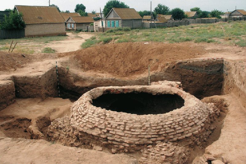
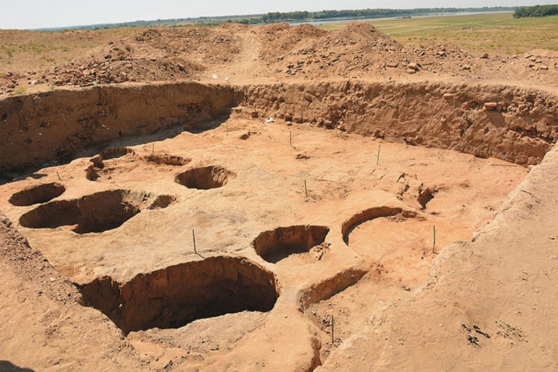
The study of the settlement has a long history. This archaeological site started to attract the attention of scientists and travelers in the 17th century. The Russian academicians Johan Falk and Ivan Lepekhin and the famous Russian historian Vasily Tatishchev mentioned the grandiose ruins in the Tsarev in their scientific notes. The systematic study of the monument began with the Volga archaeological expedition in 1959 under the direction of Professor German Fedorov-Davydov. During the expedition, a lot of work was done to clarify the topographic plan of the Tsarevskoe settlement.
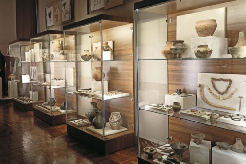
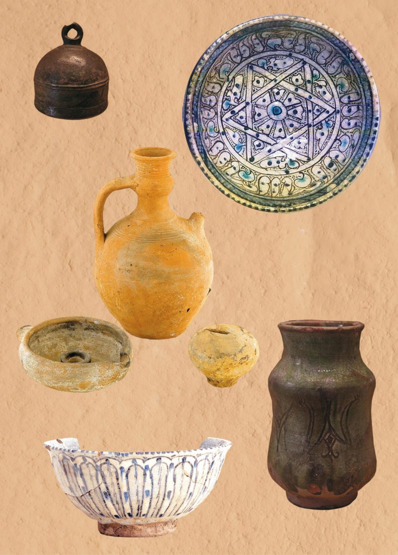
Archaeological collections, brought from the excavations, are stored and exhibited in the Volgograd Regional Museum of Local Lore and the State Hermitage.
The location for the future capital center was not chosen by chance. Since ancient times, two trade routes have passed here: the Great Volga river route from north to south and the overland route from Khorezm to the Black Sea region.
According to scientists, the city was built in the 1330-the 1340s during the heyday of the Golden Horde and became the second capital of this state. The city was formed based on the Mongolian (steppe) town-planning tradition, where the main principle was: “The center of the empire is where the khan is.”
The construction of the city began during the reign of Khan Uzbek (1283–1341). Its area, including the suburb, spread over 400 hectares. The construction went along, attracting huge amounts of material and human resources, most of which came from Central Asia.
Under Khan Janibek (?–1357), the city gained the significance of a large cultural center, whose population may have reached 100 thousand people. Not far from the city, on the high bank of the Akhtuba River, a monumental religious center was built. Famous scholars and theologians lived and worked here. Among them were the scholar Kamal ad-Din at-Turkuman and the theologian Saad ad-Din Tefrezani. Religious buildings of other religions might have been located here.
It was the city’s peak. In 1351–1352, the minting of its coin began, Tsarina Taidula issued a pass for traveling to Constantinople to the Russian Metropolitan Alexy, and an agreement with the Venetians was concluded.
However, just a few years later, the city ceased to be a major economic, political and administrative center. The reason for this were the internecine wars during the khans’ struggles for power. In a short time, the Horde was under 25 successive khans. During the reign of Khan Toktamysh, a village existed for a short time in the southern part of the settlement, where minting of coin was resumed but by 1395 life at the Tsarevskoe settlement had already frozen.
How did the city, whose traces still haunt scientists and antique lovers, look like? The layout of the city was similar to the Mongol settlements, there was no fortified center in the form of the citadel which was common for Russia and Europe. The estates of the nobility were located outside of the city without visible order and at a distance from each other. The main difference between the houses of the upper class and the buildings of ordinary townspeople was the large size of the former, the use of burnt bricks for their construction, and their architectural decor.
A trade and craft settlement with a square that had a cathedral mosque and a market gradually grew next to the city. The streets of the settlement were lined with small houses that had fenced yards and outbuildings. What interesting is that even back in this Golden Horde city there were public baths and toilets, water supply, and sewerage. Aryks, small water aqueducts, ran along the streets, and at the crossroads, there were drinking water reservoirs called hauz.
The location of the city between two rivers, Kalgut and Tsarevka, allowed the creation of a network of dams and an extensive water supply system, which provided not only the city but also its agricultural district with water. The meltwater was collected in artificial lakes and then supplied through canals to the city.
Now the main scientific interest is focused on the study of the issues related to the chronology of the Tsarevskoe settlement, the clarification of the topography of this site, and the establishment of its precise boundaries.
Museumification of the archaeological site Saray-Berke, the capital of the medieval state of the Golden Horde, will make it a tourist attraction not only on the All-Russian but also international level.
Svetlana Roldugina, Researcher, The Volgograd Regional Museum of Local Lore